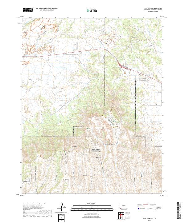
2022 Map of Point Lookout
USGS Topo · Published 2022About this map
Mesa Verde National Park dominates the southern landscape of this Montezuma County region, where the high plateaus of Moccasin Mesa, Park Mesa, and Chapin Mesa are dissected by a complex network of deep drainages. The topography here is defined by a series of parallel canyons including School Section Canyon, Prater Canyon, and Morefield Canyon, which carve southward through the mesa country. Along the North Rim, prominent landmarks like Lone Cone and the sharp profile of The Knife Edge overlook the Mancos Valley to the east.
Find a feature on this map
67 named features on this map. Tap any name to fly to it.
Don’t see what you’re looking for? This feature index may not catch every label — zoom into the map to look around manually.
Map Details
Editions of this 2022 Point Lookout Map
This is the sole edition of this map. No revisions or reprints were ever made.
Other maps of this area

1912 · Soda Canyon
USGS Topo · 1:62,500

1915 · Soda Canyon
USGS Topo · 1:62,500

1956 · Cortez
USGS Topo · 1:250,000

1958 · Cortez
USGS Topo · 1:250,000

1959 · Cortez
USGS Topo · 1:250,000

1962 · Cortez
USGS Topo · 1:250,000

1965 · Cortez
USGS Topo · 1:24,000

1965 · Dolores East
USGS Topo · 1:24,000

1965 · Dolores West
USGS Topo · 1:24,000
1965 · Millwood
USGS Topo · 1:24,000