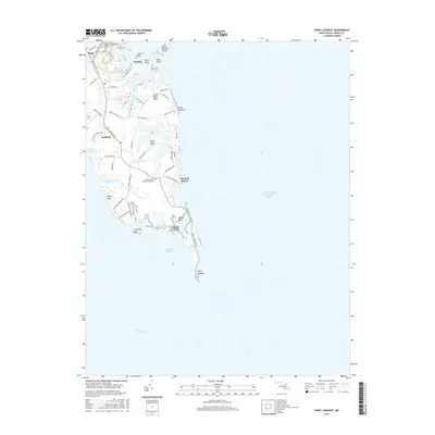
2016 Map of Point Lookout
USGS Topo · Published 2016About this map
Point Lookout marks the southern terminus of Maryland’s western shore, where the Potomac River meets the Chesapeake Bay. This 2016 survey shows the narrow peninsula's complex shoreline, defined by tidal inlets like Saint Jerome Creek and Potomac River Drive winding through the coastal landscape. The map preserves significant historical markers of the region's past, including the Point Lookout Confederate Cemetery and Saint Michael Cemetery near Ridge. Small settlements such as Scotland and Scotland Beach are interspersed with natural landmarks like Wailes Bluff and Treasure Island. The geography reveals a legacy of maritime dependence and isolated coastal life, from the reaches of Fresh Pond Neck to the sheltered waters of Cornfield Harbor, documenting the intersection of military history and bayfront residency at the mouth of the Potomac.
Find a feature on this map
58 named features on this map. Tap any name to fly to it.
Don’t see what you’re looking for? This feature index may not catch every label — zoom into the map to look around manually.
Map Details
Editions of this 2016 Point Lookout Map
This is the sole edition of this map. No revisions or reprints were ever made.
Other maps of this area

1894 · Point Lookout
USGS Topo · 1:62,500

1898 · St. Marys
USGS Topo · 1:125,000

1903 · Bloodsworth Island
USGS Topo · 1:62,500

1906 · St. Marys
USGS Topo · 1:125,000

1912 · Point Lookout
USGS Topo · 1:62,500

1917 · Heathsville
USGS Topo · 1:48,000

1917 · Ewell
USGS Topo · 1:62,500

1937 · Point Lookout
USGS Topo · 1:62,500

1942 · Richland Point
USGS Topo · 1:24,000
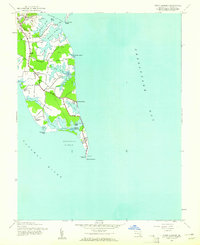
1942 · Point Lookout
USGS Topo · 1:24,000