
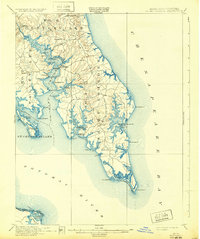
1912 Map of Point Lookout
USGS Topo · Published 1912About this map
St. Marys River and the southern tip of the Maryland-Virginia peninsula define this maritime landscape at the confluence of the Potomac River and Chesapeake Bay. In the early twentieth century, this region relied heavily on water access, as evidenced by the series of commercial landings like Broomes Wharf, Grason Wharf, and Benville Wharf that served the local economy. The map reveals a cluster of settlements such as St Inigoes, Ridge, and Great Mills connected by early inland roads, while the shoreline is deeply indented by tidal creeks like St Inigoes Cr and Smith Creek. From the prominent Point Lookout at the very tip to the settled banks of St. George Island, the geography illustrates a way of life deeply tied to the Chesapeake's shorelines and the riverine transport network prior to modern highway development.
Find a feature on this map
63 named features on this map. Tap any name to fly to it.
Don’t see what you’re looking for? This feature index may not catch every label — zoom into the map to look around manually.
Map Details
Editions of this 1912 Point Lookout Map
2 editions found
Other maps of this area

1892 · Leonardtown
USGS Topo · 1:62,500

1892 · Drum Point
USGS Topo · 1:62,500

1892 · Piney Point
USGS Topo · 1:62,500

1894 · Piney Point
USGS Topo · 1:62,500

1894 · Point Lookout
USGS Topo · 1:62,500

1895 · Leonardtown
USGS Topo · 1:62,500

1895 · Nomini
USGS Topo · 1:125,000

1895 · Piney Point
USGS Topo · 1:62,500

1898 · Nomini
USGS Topo · 1:125,000

1898 · St. Marys
USGS Topo · 1:125,000