
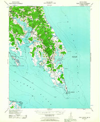
1937 Map of Point Lookout
USGS Topo · Published 1958About this map
Point Lookout marks the southern tip of this peninsula where the Potomac River meets the Chesapeake Bay. The map reveals a landscape defined by tidewater commerce and navigation in the late 1930s, featuring numerous family-named wharves like Broomes Wharf and Grason Wharf along the Saint Mary River. Inland, the road network connects small rural communities including Great Mills, Saint Mary, and St Inigoes.
Find a feature on this map
49 named features on this map. Tap any name to fly to it.
Don’t see what you’re looking for? This feature index may not catch every label — zoom into the map to look around manually.
Map Details
Editions of this 1937 Point Lookout Map
2 editions found
Other maps of this area

1892 · Leonardtown
USGS Topo · 1:62,500

1892 · Drum Point
USGS Topo · 1:62,500

1892 · Piney Point
USGS Topo · 1:62,500

1894 · Piney Point
USGS Topo · 1:62,500

1894 · Point Lookout
USGS Topo · 1:62,500

1895 · Leonardtown
USGS Topo · 1:62,500

1895 · Nomini
USGS Topo · 1:125,000

1895 · Piney Point
USGS Topo · 1:62,500

1898 · Nomini
USGS Topo · 1:125,000

1898 · St. Marys
USGS Topo · 1:125,000