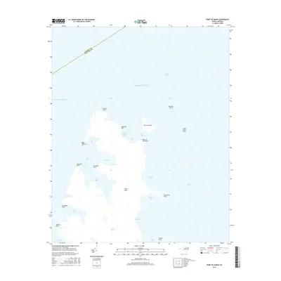
2016 Map of Point of Marsh
USGS Topo · Published 2016About this map
Point of Marsh defines the terminus of a complex estuarine landscape where the Atlantic Ocean meets the expansive Pamlico Sound. This maritime environment is characterized by a dense network of bays and points, including the protected waters of North Bay, East Bay, and South Bay. The geographic transition is marked by the boundary between Pamlico and Carteret counties, highlighting the strategic importance of waterways like The Narrows and Meredith Bend. The map reveals a world of low-lying islands and secluded harbors, such as Henry Hills Harbor and Raccoon Island, which speak to the area's history of navigation and coastal refuge. Numerous family or descriptive landmarks like Dowdy Point and Mulberry Point provide clear reference points for those studying the shifting shorelines of this coastal region.
Find a feature on this map
33 named features on this map. Tap any name to fly to it.
Don’t see what you’re looking for? This feature index may not catch every label — zoom into the map to look around manually.
Map Details
Editions of this 2016 Point of Marsh Map
This is the sole edition of this map. No revisions or reprints were ever made.
Other maps of this area

1948 · North Bay
USGS Topo · 1:24,000

1949 · Atlantic
USGS Topo · 1:24,000

1949 · Point Of Marsh
USGS Topo · 1:24,000

1949 · Long Bay
USGS Topo · 1:24,000

1949 · South River
USGS Topo · 1:24,000

1950 · Long Bay
USGS Topo · 1:24,000

1950 · South River
USGS Topo · 1:24,000

1950 · North Bay
USGS Topo · 1:24,000

1950 · Point Of Marsh
USGS Topo · 1:24,000

1950 · Jones Bay
USGS Topo · 1:24,000