
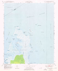
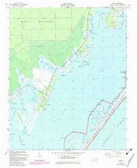
1950 Map of South River
USGS Topo · Published 1950About this map
The Neuse River shoreline and the intricate wetlands of South River dominate this coastal landscape, showing a geography defined by tidal creeks and marshy points. Small settlements like South River and Lukens are situated along these waterways, reflecting a community oriented toward the water before mid-century modernization. The presence of the Landing Field and the South River Light highlights the area's importance for both aerial and maritime navigation along the North Carolina coast.
Find a feature on this map
44 named features on this map. Tap any name to fly to it.
Don’t see what you’re looking for? This feature index may not catch every label — zoom into the map to look around manually.
Map Details
Editions of this 1950 South River Map
This is the sole edition of this map. No revisions or reprints were ever made.
Other maps of this area
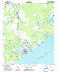
1948 · Oriental
USGS Topo · 1:24,000
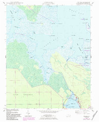
1949 · Point Of Marsh
USGS Topo · 1:24,000
1949 · Long Bay
USGS Topo · 1:24,000
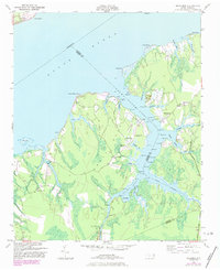
1949 · Merrimon
USGS Topo · 1:24,000

1949 · Williston
USGS Topo · 1:24,000

1949 · South River
USGS Topo · 1:24,000
1949 · Davis
USGS Topo · 1:24,000

1949 · Core Creek
USGS Topo · 1:24,000
1950 · Long Bay
USGS Topo · 1:24,000

1950 · Point Of Marsh
USGS Topo · 1:24,000