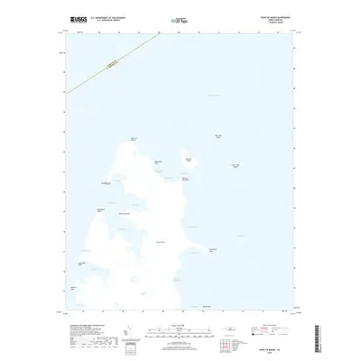
2019 Map of Point of Marsh
USGS Topo · Published 2019About this map
Pamlico Sound dominates this coastal survey, where the boundary between Pamlico County and Carteret County meets the water. The landscape is defined by an intricate network of marshes and islands, most notably the large landmass of Piney Island and the smaller, outlying Big Swan Island and Little Swan Island. The coastline is deeply indented by numerous bays and harbors, including North Bay, East Bay, and South Bay, which carve into the mainland near Point of Marsh. Narrow waterways like The Narrows separate Raccoon Island from the surrounding marshlands, while smaller features such as Henry Hills Harbor and Deep Hole Harbor provide sheltered pockets along the sound's edge. This map documents a transitional aquatic environment, illustrating the complex shoreline and scattered islands characteristic of the North Carolina coast before modern development or significant topographic changes altered the natural flow of the sound.
Find a feature on this map
32 named features on this map. Tap any name to fly to it.
Don’t see what you’re looking for? This feature index may not catch every label — zoom into the map to look around manually.
Map Details
Editions of this 2019 Point of Marsh Map
This is the sole edition of this map. No revisions or reprints were ever made.
Other maps of this area

1948 · North Bay
USGS Topo · 1:24,000

1949 · Atlantic
USGS Topo · 1:24,000

1949 · Point Of Marsh
USGS Topo · 1:24,000

1949 · Long Bay
USGS Topo · 1:24,000

1949 · South River
USGS Topo · 1:24,000

1950 · Long Bay
USGS Topo · 1:24,000

1950 · South River
USGS Topo · 1:24,000

1950 · North Bay
USGS Topo · 1:24,000

1950 · Point Of Marsh
USGS Topo · 1:24,000

1950 · Jones Bay
USGS Topo · 1:24,000