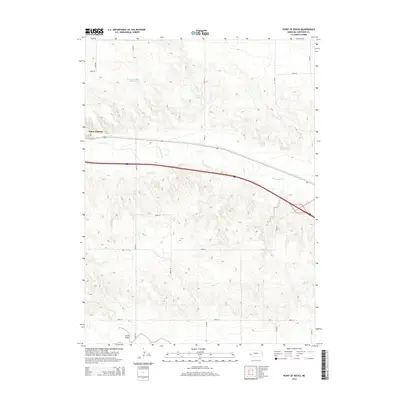
2014 Map of Point of Rocks
USGS Topo · Published 2014About this map
Point of Rocks overlooks a high plains landscape in Cheyenne County, defined by the winding course of Lodgepole Cr and a network of section-line roads. This part of Western Nebraska shows a transition from the elevated plateaus down into the drainage of Sand Draw, where intermittent water sources and artificial catchments like Herboldshiemer Reservoir and Nelson Pond support the local ranching and agricultural economy. The terrain is marked by the distinct escarpments of the Panhandle, where high ridges break into lower valleys. Transport through this area is anchored by the east-west corridor following the creek, a route that has historically connected the region's scattered homesteads and pastures.
Find a feature on this map
15 named features on this map. Tap any name to fly to it.
Don’t see what you’re looking for? This feature index may not catch every label — zoom into the map to look around manually.
Map Details
Editions of this 2014 Point of Rocks Map
This is the sole edition of this map. No revisions or reprints were ever made.
Other maps of this area

1954 · Scottsbluff
USGS Topo · 1:250,000

1958 · Scottsbluff
USGS Topo · 1:250,000

1972 · Mud Springs SW
USGS Topo · 1:24,000

1972 · Easterly Airport
USGS Topo · 1:24,000

1972 · Lorenzo
USGS Topo · 1:24,000

1972 · Point Of Rocks
USGS Topo · 1:24,000

1972 · Brownson
USGS Topo · 1:24,000

1972 · Mud Springs SE
USGS Topo · 1:24,000

1972 · Potter SE
USGS Topo · 1:24,000

1972 · Potter
USGS Topo · 1:24,000