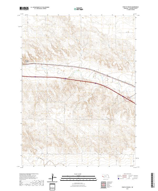
2021 Map of Point of Rocks
USGS Topo · Published 2021About this map
Point of Rocks serves as a prominent landmark in this section of Cheyenne County, where the High Plains terrain is carved by seasonal watercourses. The drainage of Lodgepole Cr winds across the northern half of the landscape, while the wide basin of Sand Draw defines the southern reaches. This modern topographic record shows a distinct pattern of large-scale land management, characterized by a sparse network of section-line roads such as RD 87 and RD 24. The area maintains a rural, agricultural character with very few concentrated settlements, preserving the open spatial relationship between the natural topography and the surveyed grid of the American West.
Find a feature on this map
21 named features on this map. Tap any name to fly to it.
Don’t see what you’re looking for? This feature index may not catch every label — zoom into the map to look around manually.
Map Details
Editions of this 2021 Point of Rocks Map
This is the sole edition of this map. No revisions or reprints were ever made.
Other maps of this area

1954 · Scottsbluff
USGS Topo · 1:250,000

1958 · Scottsbluff
USGS Topo · 1:250,000

1972 · Mud Springs SW
USGS Topo · 1:24,000

1972 · Easterly Airport
USGS Topo · 1:24,000

1972 · Lorenzo
USGS Topo · 1:24,000

1972 · Point Of Rocks
USGS Topo · 1:24,000

1972 · Brownson
USGS Topo · 1:24,000

1972 · Mud Springs SE
USGS Topo · 1:24,000

1972 · Potter SE
USGS Topo · 1:24,000

1972 · Potter
USGS Topo · 1:24,000