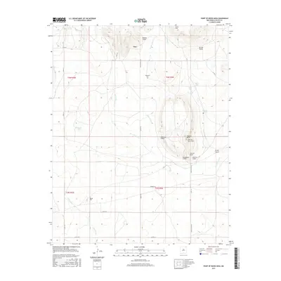
2017 Map of Point of Rocks Mesa
USGS Topo · Published 2017About this map
Chico stands as the primary settlement in this northeastern New Mexico landscape, situated amidst a complex network of arroyos and canyons. The geography is defined by high-elevation landmarks such as Point of Rocks Mesa and Hogback Butte, which overlook the surrounding drainage basins. Water sources are critical features in this arid environment, represented by the persistent presence of Chico Springs, Willow Springs, and Seward Lake.
Find a feature on this map
38 named features on this map. Tap any name to fly to it.
Don’t see what you’re looking for? This feature index may not catch every label — zoom into the map to look around manually.
Map Details
Editions of this 2017 Point of Rocks Mesa Map
This is the sole edition of this map. No revisions or reprints were ever made.
Other maps of this area

1954 · Raton
USGS Topo · 1:250,000

1958 · Raton
USGS Topo · 1:250,000

1965 · Sauble Circle Dot Ranch
USGS Topo · 1:24,000

1965 · Abbott
USGS Topo · 1:24,000

1971 · Tres Hermanos Peak
USGS Topo · 1:24,000

1971 · Pine Buttes
USGS Topo · 1:24,000

1971 · Palo Blanco Mountain
USGS Topo · 1:24,000

1974 · Point Of Rocks Mesa
USGS Topo · 1:24,000

1974 · Farley
USGS Topo · 1:24,000
1974 · Lawrence Arroyo
USGS Topo · 1:24,000