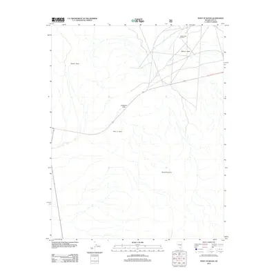
2012 Map of Point of Rocks
USGS Topo · Published 2012About this map
Mercury Valley and Strawberry Valley converge in this high-desert landscape of Nye County, where the topography is defined by the sharp elevations of the Specter Range to the northwest and the Spring Mountains to the southeast. The central corridor is dominated by the prominent Point of Rocks formation, a landmark that orients travel through this arid basin. This 2012 survey illustrates the modern transportation and aviation infrastructure of the region, specifically the Desert Rock Airstrip located in the northeast. The map provides a precise view of the road networks that lace through the valleys, connecting remote desert ranges with mid-century airstrip facilities in an area characterized by its open basins and stark mountainous boundaries.
Find a feature on this map
6 named features on this map. Tap any name to fly to it.
Don’t see what you’re looking for? This feature index may not catch every label — zoom into the map to look around manually.
Map Details
Editions of this 2012 Point of Rocks Map
This is the sole edition of this map. No revisions or reprints were ever made.
Other maps of this area

1907 · Las Vegas
USGS Topo · 1:250,000

1908 · Furnace Creek
USGS Topo · 1:250,000

1908 · Las Vegas
USGS Topo · 1:250,000

1910 · Furnace Creek
USGS Topo · 1:250,000

1942 · Indian Spring
USGS Topo · 1:125,000

1942 · Skull Mountain
USGS Topo · 1:125,000

1948 · Death Valley
USGS Topo · 1:250,000

1952 · Specter Range
USGS Topo · 1:62,500

1952 · Mercury
USGS Topo · 1:62,500

1954 · Las Vegas
USGS Topo · 1:250,000