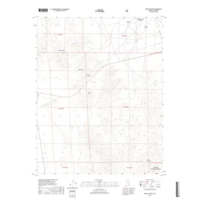
2018 Map of Point of Rocks
USGS Topo · Published 2018About this map
Camp Desert Rock stands as a focal point in this portion of the Mojave Desert, serving as a legacy of military activity in the mid-20th century. The landscape is defined by the sharp elevations of the Specter Range and the northern reaches of the Spring Mountains, which overlook the flat expanses of Strawberry Valley and Mercury Valley. The presence of the Desert Rock Airport and proximity to the Mercury Hwy highlights the region's role as a support corridor for the Nevada Test Site. To the southeast, the boundary of the Toiyabe National Forest indicates the transition from arid basin floors to high-altitude woodland. The map also captures the namesake Point of Rocks, a distinct topographic landmark amidst the desert terrain.
Find a feature on this map
18 named features on this map. Tap any name to fly to it.
Don’t see what you’re looking for? This feature index may not catch every label — zoom into the map to look around manually.
Map Details
Editions of this 2018 Point of Rocks Map
This is the sole edition of this map. No revisions or reprints were ever made.
Other maps of this area

1907 · Las Vegas
USGS Topo · 1:250,000

1908 · Furnace Creek
USGS Topo · 1:250,000

1908 · Las Vegas
USGS Topo · 1:250,000

1910 · Furnace Creek
USGS Topo · 1:250,000

1942 · Indian Spring
USGS Topo · 1:125,000

1942 · Skull Mountain
USGS Topo · 1:125,000

1948 · Death Valley
USGS Topo · 1:250,000

1952 · Specter Range
USGS Topo · 1:62,500

1952 · Mercury
USGS Topo · 1:62,500

1954 · Las Vegas
USGS Topo · 1:250,000