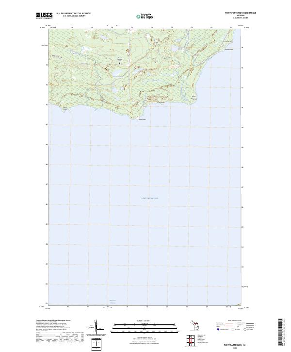
2023 Map of Point Patterson
USGS Topo · Published 2023About this map
Newton Township Cem stands as a focal point for genealogical interest in this coastal stretch of Mackinac County, situated north of the rugged Lake Michigan shoreline. The landscape is defined by a series of prominent coastal projections, including Point Patterson, Scott Point, and Cozy Point, which break the shoreline between Birch Point and Grants Point. Inland, the terrain is characterized by a network of wetlands and small lakes, such as Stone Lake, Island Lake, and Bruders Lake. These water bodies are connected by narrow drainages like the Cataract River, Newton Creek, and Hudson Creek, which flow toward the Mackinac Channel. Local transit is facilitated by rural routes such as Leveille Rd and S Gould City Rd, providing access through the timbered tracts of Newton Township.
Find a feature on this map
23 named features on this map. Tap any name to fly to it.
Don’t see what you’re looking for? This feature index may not catch every label — zoom into the map to look around manually.
Map Details
Editions of this 2023 Point Patterson Map
This is the sole edition of this map. No revisions or reprints were ever made.
Other maps of this area

1931 · Seul Choix Point NE
USGS Topo · 1:31,680

1931 · Gould City SE
USGS Topo · 1:31,680

1931 · Blaney SE
USGS Topo · 1:31,680

1954 · Sault Sainte Marie
USGS Topo · 1:250,000

1955 · Cheboygan
USGS Topo · 1:250,000

1956 · Sault Sainte Marie
USGS Topo · 1:250,000

1957 · Sault Sainte Marie
USGS Topo · 1:250,000

1958 · Cheboygan
USGS Topo · 1:250,000

1958 · Sault Sainte Marie
USGS Topo · 1:250,000
1972 · Hughes Point
USGS Topo · 1:24,000