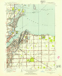
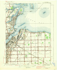
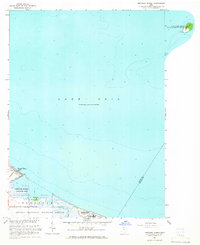
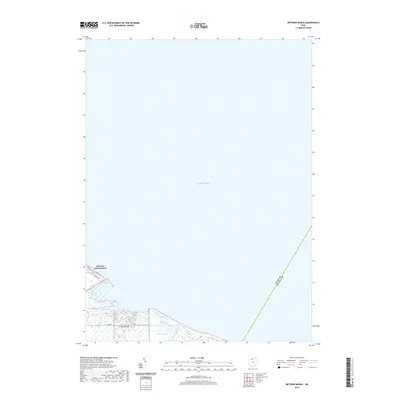
1952 Map of Point Place
USGS Topo · Published 1954About this map
Maumee Bay and the Maumee River define this industrial and coastal landscape, where the Michigan-Ohio border crosses through the waters of North Maumee Bay. The 1950s waterfront is a dense network of maritime and rail infrastructure, from the Naval Armory and Toledo Yacht Club to the massive Homestead Yard serving the New York Central and Terminal RR. Inland, the transition from urban Toledo to the rural reaches of Jerusalem Township is evident in the grid of drainage ditches like Amlosch Ditch and Johlin Ditch that reclaimed this low-lying lakeside terrain for development.
Find a feature on this map
68 named features on this map. Tap any name to fly to it.
Don’t see what you’re looking for? This feature index may not catch every label — zoom into the map to look around manually.
Map Details
Editions of this 1952 Point Place Map
This is the sole edition of this map. No revisions or reprints were ever made.
Historical Maps of Toledo Through Time
10 maps found
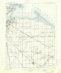
1900 Maumee Bay
Lucas County, OH
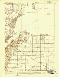
1934 Point Place
Lucas County, OH
1938 Point Place
Lucas County, OH
1952 Point Place
Lucas County, OH
1964 Metzger Marsh
Lucas County, OH
2010 Metzger Marsh
Lucas County, OH
2013 Metzger Marsh
Lucas County, OH
2016 Metzger Marsh
Lucas County, OH
2019 Metzger Marsh
Lucas County, OH
2023 Metzger Marsh
Lucas County, OH