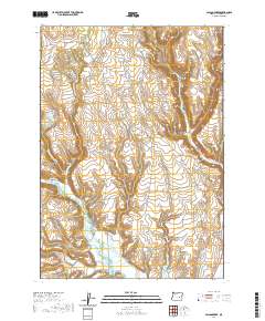
2020 Map of Poison Creek
USGS Topo · Published 2020About this map
Silvies River and its intricate waterway system dominate this high-desert landscape in central Harney County. The drainage network includes Foley Slough, Fivemile Slough, and the Arntz Reservoir, illustrating the critical importance of water management in this arid region. The terrain transitions from the low-lying wetlands of the river valley to prominent basaltic features like Arrowhead Butte and the high elevations of Mahogany Ridge. Numerous water sources are tucked into the canyons, such as Thousand Springs, Coal Pit Spring, and Black Spring, which likely served as vital landmarks for early ranchers and travelers. The presence of Devine Canyon and Theimer Canyon in the northeast highlights the dramatic erosion patterns of the area, while a sparse network of roads like Lone Pine Rd and Curry Garden Rd connects the remote basins.
Find a feature on this map
32 named features on this map. Tap any name to fly to it.
Don’t see what you’re looking for? This feature index may not catch every label — zoom into the map to look around manually.
Map Details
Editions of this 2020 Poison Creek Map
This is the sole edition of this map. No revisions or reprints were ever made.
Other maps of this area

1955 · Burns
USGS Topo · 1:250,000

1958 · Burns
USGS Topo · 1:250,000

1959 · Burns
USGS Topo · 1:250,000

1959 · West Myrtle Butte
USGS Topo · 1:62,500

1959 · Harney
USGS Topo · 1:62,500

1960 · Burns
USGS Topo · 1:62,500

1960 · Burns
USGS Topo · 1:24,000

1961 · Calamity Butte
USGS Topo · 1:62,500

1975 · Burns
USGS Topo · 1:24,000

1978 · Stinkingwater Mountains
USGS Topo · 1:100,000