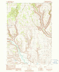
1990 Map of Poison Creek
USGS Topo · Published 1990About this map
Mahogany Ridge and the volcanic landscape of Devils Garden define this high-desert region of Harney County as it appeared in the late 1980s. The drainage of the Silvies River anchors the southwest corner, where water management is evident at Fivemile Dam and the Arntz Reservoir. This 1990 provisional edition documents a network of family-held cattle operations, including the Thousand Spring Ranch, Hart Ranch, and Peterson Ranch, illustrating the persistent ranching economy of the Harney Valley outskirts. The map also records the Poison Creek (Site) and various spring-fed locations like Theimer Spring and Coal Pit Spring, which served as vital resources in a landscape carved by deep coulees such as Fenwick Canyon and Heifer Canyon.
Find a feature on this map
32 named features on this map. Tap any name to fly to it.
Don’t see what you’re looking for? This feature index may not catch every label — zoom into the map to look around manually.
Map Details
Editions of this 1990 Poison Creek Map
This is the sole edition of this map. No revisions or reprints were ever made.
Other maps of this area

1955 · Burns
USGS Topo · 1:250,000

1958 · Burns
USGS Topo · 1:250,000

1959 · Burns
USGS Topo · 1:250,000

1959 · West Myrtle Butte
USGS Topo · 1:62,500

1959 · Harney
USGS Topo · 1:62,500

1960 · Burns
USGS Topo · 1:62,500

1960 · Burns
USGS Topo · 1:24,000

1961 · Calamity Butte
USGS Topo · 1:62,500

1975 · Burns
USGS Topo · 1:24,000

1978 · Stinkingwater Mountains
USGS Topo · 1:100,000