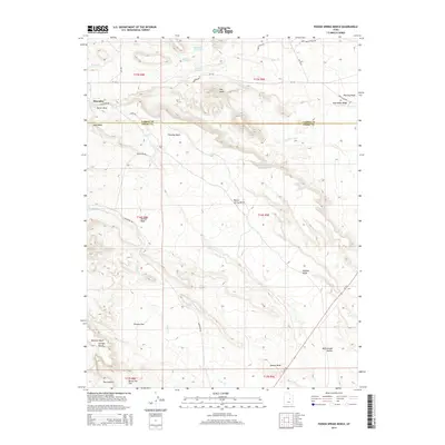
2014 Map of Poison Spring Bench
USGS Topo · Published 2014About this map
Poison Spring Bench dominates this high-altitude landscape along the border of Carbon and Emery counties. The settlement of Hiawatha is situated in the northwestern corner, serving as a focal point for the region's historical industrial activity. This survey captures the complex drainage systems and arid plateaus of eastern Utah, where deep incisions like Wildcat Draw and Jackass Wash carve through the terrain. The presence of Millerton Reservoir and several vital water sources, including Clawson Spring and Goat Ranch Spring, indicates the essential infrastructure required for survival and industry in this environment. Named landforms such as The Knoll, Trimble Flat, and Oil Well Bench suggest a history of prospecting and ranching that defined the local economy during the early 21st century.
Find a feature on this map
40 named features on this map. Tap any name to fly to it.
Don’t see what you’re looking for? This feature index may not catch every label — zoom into the map to look around manually.
Map Details
Editions of this 2014 Poison Spring Bench Map
This is the sole edition of this map. No revisions or reprints were ever made.
Other maps of this area

1885 · Manti
USGS Topo · 1:250,000

1886 · Price River
USGS Topo · 1:250,000

1895 · Manti
USGS Topo · 1:250,000

1896 · Price River
USGS Topo · 1:250,000

1914 · Castle Gate
USGS Topo · 1:62,500

1916 · Castle Gate
USGS Topo · 1:62,500

1923 · Scofield
USGS Topo · 1:62,500

1923 · Hiawatha
USGS Topo · 1:62,500

1925 · Scofield
USGS Topo · 1:62,500

1925 · Hiawatha
USGS Topo · 1:62,500