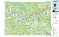
1992 Map of Pokegama Lake
USGS Topo · Published 1992About this map
The Iron Range landscape dominates this survey of Itasca County, where the industrial legacy of mining meets the vast water systems of north-central Minnesota. The corridor of U.S. 169 connects the production hubs of Keewatin, Nashwauk, and Coleraine, characterized by significant Mine Dump markings that define the local topography. At the center, Grand Rapids serves as the regional anchor near the sprawling Pokegama Lake and the winding Mississippi River.
Find a feature on this map
66 named features on this map. Tap any name to fly to it.
Don’t see what you’re looking for? This feature index may not catch every label — zoom into the map to look around manually.
Map Details
Editions of this 1992 Pokegama Lake Map
This is the sole edition of this map. No revisions or reprints were ever made.
Other maps of this area

1919 · Max
USGS Topo · 1:62,500

1919 · Release
USGS Topo · 1:62,500

1919 · Marcell
USGS Topo · 1:62,500

1920 · Trout Lake
USGS Topo · 1:62,500

1943 · Release
USGS Topo · 1:62,500

1951 · Hibbing
USGS Topo · 1:24,000

1952 · Keewatin
USGS Topo · 1:24,000

1952 · Riley
USGS Topo · 1:24,000

1952 · Nashwauk
USGS Topo · 1:24,000

1952 · Silica
USGS Topo · 1:24,000