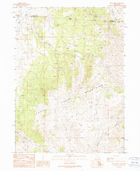
1990 Map of Pole Creek
USGS Topo · Published 1990About this map
The Emigrant Trail cuts through the high desert landscape of the Goose Creek Mountains, following a historic path used by westward travelers. This 1990 provisional survey captures a remote section of the borderlands between Cassia County, Idaho and Box Elder County, Utah, where the drainage systems of Goose Creek and Pole Creek define the rugged topography. The map illustrates a high-altitude wilderness shaped by intermittent streams and seasonal water sources like Birch Creek and Hardesty Creek.
Find a feature on this map
12 named features on this map. Tap any name to fly to it.
Don’t see what you’re looking for? This feature index may not catch every label — zoom into the map to look around manually.
Map Details
Editions of this 1990 Pole Creek Map
This is the sole edition of this map. No revisions or reprints were ever made.
Other maps of this area

1954 · Pocatello
USGS Topo · 1:250,000

1954 · Brigham City
USGS Topo · 1:250,000

1955 · Twin Falls
USGS Topo · 1:250,000

1955 · Wells
USGS Topo · 1:250,000

1958 · Wells
USGS Topo · 1:250,000

1958 · Twin Falls
USGS Topo · 1:250,000

1958 · Pocatello
USGS Topo · 1:250,000

1958 · Brigham City
USGS Topo · 1:250,000

1959 · Cotton Thomas Basin
USGS Topo · 1:62,500

1961 · Wells
USGS Topo · 1:250,000