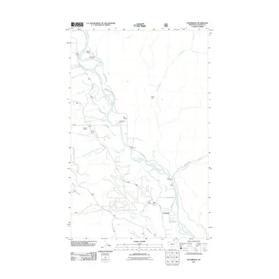
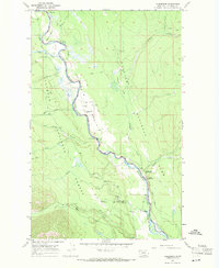
2011 Map of Polebridge
USGS Topo · Published 2011About this map
The North Fork Flathead River serves as the central artery for this remote region of Flathead County, defining the western boundary of Glacier National Park. The settlement of Polebridge stands as a primary outpost, connected by a network of rural routes including Polebridge Loop and Hay Creek Rd. The landscape is characterized by wide alluvial openings like Round Prairie and Big Prairie, which provide space for habitation and agriculture such as the Quarter Circle MC Ranch. Aviation and outdoor recreation are also established here, evidenced by the Searight Airport, the Cimino Airstrip, and several riverfront sites like the Mud Creek Campground and River Campground. Numerous tributaries, including Whale Creek, Moose Creek, and Akokala Creek, feed into the main river channel from the surrounding timberlands.
Find a feature on this map
34 named features on this map. Tap any name to fly to it.
Don’t see what you’re looking for? This feature index may not catch every label — zoom into the map to look around manually.
Map Details
Editions of this 2011 Polebridge Map
This is the sole edition of this map. No revisions or reprints were ever made.
Other maps of this area

1906 · Kintla Lakes
USGS Topo · 1:125,000

1938 · Kintla Lakes
USGS Topo · 1:125,000

1957 · Kalispell
USGS Topo · 1:250,000

1960 · Kalispell
USGS Topo · 1:250,000

1961 · Kalispell
USGS Topo · 1:250,000
1966 · Demers Ridge
USGS Topo · 1:24,000

1966 · Kintla Lake
USGS Topo · 1:24,000
1966 · Moose Peak
USGS Topo · 1:24,000
1966 · Whale Buttes
USGS Topo · 1:24,000
1966 · Polebridge
USGS Topo · 1:24,000