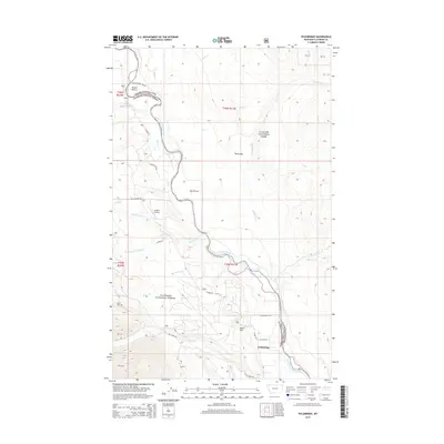
2014 Map of Polebridge
USGS Topo · Published 2014About this map
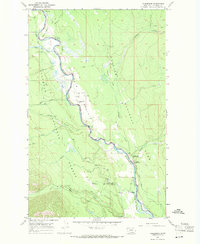
The North Fork Flathead River serves as a natural boundary between two vast protected areas, with Glacier National Park to the east and the Flathead National Forest to the west. This 2014 survey captures the remote settlement of Polebridge, a gateway community situated at the intersection of Polebridge Loop and Glacier Dr. The landscape is defined by wide glacial valleys and alluvial flats, including Big Prairie and Tepee Flat, which provide breaks in the densely forested terrain. Aviation access in this wilderness corridor is noted at Langton Airstrip, while the northern portion of the quadrangle shows the smaller clearing of Round Prairie. Several major tributaries, including Akokala Cr and Bowman Cr, descend from the high peaks of the park to join the main river channel, illustrating the hydrologic importance of this drainage basin.
Find a feature on this map
38 named features on this map. Tap any name to fly to it.
Don’t see what you’re looking for? This feature index may not catch every label — zoom into the map to look around manually.
Map Details
Editions of this 2014 Polebridge Map
This is the sole edition of this map. No revisions or reprints were ever made.
Other maps of this area

1906 · Kintla Lakes
USGS Topo · 1:125,000

1938 · Kintla Lakes
USGS Topo · 1:125,000

1957 · Kalispell
USGS Topo · 1:250,000

1960 · Kalispell
USGS Topo · 1:250,000

1961 · Kalispell
USGS Topo · 1:250,000
1966 · Demers Ridge
USGS Topo · 1:24,000

1966 · Kintla Lake
USGS Topo · 1:24,000
1966 · Moose Peak
USGS Topo · 1:24,000
1966 · Whale Buttes
USGS Topo · 1:24,000
1966 · Polebridge
USGS Topo · 1:24,000