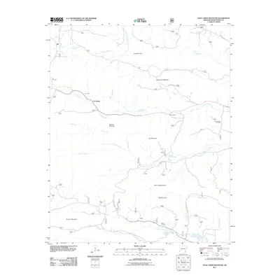
2011 Map of Polk Creek Mountain
USGS Topo · Published 2011About this map
The South Fork Ouachita River and the Caddo River define the complex drainage patterns of this Montgomery County landscape, where deep ridges and narrow creek valleys have shaped local settlement. Notable landmarks include the CCC Camp and Cox Spring, remnants of a time when mountain water sources and public works programs dictated the geography of the Ouachita National Forest area. The map illustrates a network of forest service roads, such as Beech Creek Rd and Albert Pike Rd, connecting remote sites like the settlement at Alf. Genealogists will find several small burial grounds documented across the terrain, including Cox Cemetery, Scott Cemetery, and Mount Gilead Cemetery. From Polk Creek Mountain to Sherman Mountain, the topography highlights the isolation of these highlands, where historic homesteads were often situated near named water sources like Dry Fork and Lick Creek.
Find a feature on this map
72 named features on this map. Tap any name to fly to it.
Don’t see what you’re looking for? This feature index may not catch every label — zoom into the map to look around manually.
Map Details
Editions of this 2011 Polk Creek Mountain Map
This is the sole edition of this map. No revisions or reprints were ever made.
Other maps of this area

1890 · Mount Ida
USGS Topo · 1:125,000

1906 · Caddo Gap
USGS Topo · 1:125,000

1936 · Athens
USGS Topo · 1:48,000

1936 · Glenwood
USGS Topo · 1:48,000

1942 · Glenwood
USGS Topo · 1:62,500

1942 · Athens
USGS Topo · 1:62,500

1949 · Glenwood
USGS Topo · 1:62,500

1955 · Little Rock
USGS Topo · 1:250,000

1956 · Little Rock
USGS Topo · 1:250,000

1959 · Oden
USGS Topo · 1:62,500