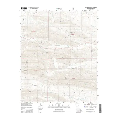
2014 Map of Polk Creek Mountain
USGS Topo · Published 2014About this map
Alf and the secluded Back Valley anchor this 2014 survey of Montgomery County's mountainous terrain. Much of the land is preserved within the Ouachita National Forest, where the complex drainage systems of the S Fork Ouachita River and the Caddo River carve through high ridges. Notable peaks such as Bearden Mtn, Cub Mtn, and Statehouse Mtn define the topography, while local road networks like State Hwy 8 and State Hwy 240 connect these isolated valleys. For genealogists, the map identifies several significant burial sites, including Mt Gilead Cem near Mt Gilead Church Rd and the Scott Cem situated near the banks of the Caddo River. The map also reveals the locations of remote homestead landmarks like Cox Spring and Cox Cem, illustrating the persistent presence of family settlements within this heavily forested landscape.
Find a feature on this map
81 named features on this map. Tap any name to fly to it.
Don’t see what you’re looking for? This feature index may not catch every label — zoom into the map to look around manually.
Map Details
Editions of this 2014 Polk Creek Mountain Map
This is the sole edition of this map. No revisions or reprints were ever made.
Other maps of this area

1890 · Mount Ida
USGS Topo · 1:125,000

1906 · Caddo Gap
USGS Topo · 1:125,000

1936 · Athens
USGS Topo · 1:48,000

1936 · Glenwood
USGS Topo · 1:48,000

1942 · Glenwood
USGS Topo · 1:62,500

1942 · Athens
USGS Topo · 1:62,500

1949 · Glenwood
USGS Topo · 1:62,500

1955 · Little Rock
USGS Topo · 1:250,000

1956 · Little Rock
USGS Topo · 1:250,000

1959 · Oden
USGS Topo · 1:62,500