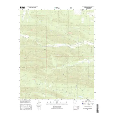
2017 Map of Polk Creek Mountain
USGS Topo · Published 2017About this map
The Ouachita National Forest dominates this section of western Arkansas, where the ridges of the Caddo Mountains and peaks like Polk Creek Mountain dictate the flow of water and human settlement. The drainage patterns are clearly defined by the Caddo River and the S Fork Ouachita River, which carve through the dense terrain. Small settlements and points of interest are sparse but significant for local history, including the community of Alf and family-named landmarks like Cox Spring. For genealogists, the map preserves the exact locations of remote burial grounds such as Mount Gilead Cem, Cox Cem, and Stover Cem. The road network, including State Hwy 240 and Albert Pike Rd, highlights the primary routes through these valleys in the early 21st century, showing how infrastructure has adapted to the steep slopes of Long Mtn and Sherman Mtn.
Find a feature on this map
40 named features on this map. Tap any name to fly to it.
Don’t see what you’re looking for? This feature index may not catch every label — zoom into the map to look around manually.
Map Details
Editions of this 2017 Polk Creek Mountain Map
This is the sole edition of this map. No revisions or reprints were ever made.
Other maps of this area

1890 · Mount Ida
USGS Topo · 1:125,000

1906 · Caddo Gap
USGS Topo · 1:125,000

1936 · Athens
USGS Topo · 1:48,000

1936 · Glenwood
USGS Topo · 1:48,000

1942 · Glenwood
USGS Topo · 1:62,500

1942 · Athens
USGS Topo · 1:62,500

1949 · Glenwood
USGS Topo · 1:62,500

1955 · Little Rock
USGS Topo · 1:250,000

1956 · Little Rock
USGS Topo · 1:250,000

1959 · Oden
USGS Topo · 1:62,500