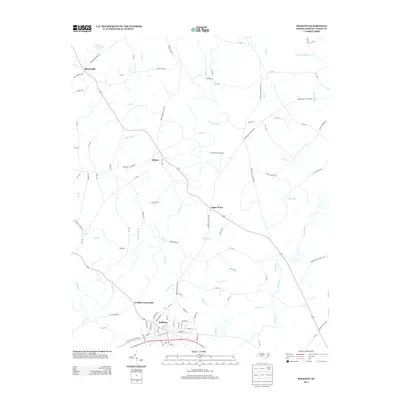
2013 Map of Polkton
USGS Topo · Published 2013About this map
Polkton anchors the southern portion of this Anson County landscape, situated where the corridor of Old US Hwy 74 meets several local routes. The area is defined by a dense network of watercourses, including the meandering Lanes Cr and the extensive Brown Cr drainage system. Small named settlements like Burnsville, Kikers, and Sugar Town dot the rural interior, connected by roads that frequently take their names from local landmarks and congregations, such as Hopewell Church Rd and Cedar Grove Church Rd. This 2013 survey illustrates the enduring rural character of the region, where legacy crossroads like Griffins Crossroads remain central to the local geography. Significant local industry and land use are evidenced by features such as High Rock Crusher Rd and the D and J Farms Lake, highlighting the intersection of agriculture and transit in the North Carolina piedmont.
Find a feature on this map
106 named features on this map. Tap any name to fly to it.
Don’t see what you’re looking for? This feature index may not catch every label — zoom into the map to look around manually.
Map Details
Editions of this 2013 Polkton Map
This is the sole edition of this map. No revisions or reprints were ever made.
Other maps of this area

1941 · Spartanburg
USGS Topo · 1:250,000

1953 · Spartanburg
USGS Topo · 1:250,000

1953 · Charlotte
USGS Topo · 1:250,000

1954 · Charlotte
USGS Topo · 1:250,000

1956 · Ansonville
USGS Topo · 1:24,000

1956 · Mount Gilead West
USGS Topo · 1:24,000

1956 · Wadesboro
USGS Topo · 1:24,000

1960 · Charlotte
USGS Topo · 1:250,000

1960 · Spartanburg
USGS Topo · 1:250,000

1962 · Charlotte
USGS Topo · 1:250,000