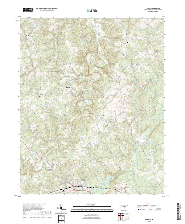
2022 Map of Polkton
USGS Topo · Published 2022About this map
Polkton and the surrounding Anson County countryside appear here in contemporary detail, anchored by the South Piedmont Community College L L Polk Campus and the local street grid. The landscape is defined by the branching tributaries of Lanes Creek, which winds through the center of the quadrangle, and Brown Creek to the southeast. These waterways and the ridges between them have long shaped the settlement patterns of rural communities like Burnsville, Kikers, and Sugar Town.
Find a feature on this map
111 named features on this map. Tap any name to fly to it.
Don’t see what you’re looking for? This feature index may not catch every label — zoom into the map to look around manually.
Map Details
Editions of this 2022 Polkton Map
This is the sole edition of this map. No revisions or reprints were ever made.
Other maps of this area

1941 · Spartanburg
USGS Topo · 1:250,000

1953 · Spartanburg
USGS Topo · 1:250,000

1953 · Charlotte
USGS Topo · 1:250,000

1954 · Charlotte
USGS Topo · 1:250,000

1956 · Ansonville
USGS Topo · 1:24,000

1956 · Mount Gilead West
USGS Topo · 1:24,000

1956 · Wadesboro
USGS Topo · 1:24,000

1960 · Charlotte
USGS Topo · 1:250,000

1960 · Spartanburg
USGS Topo · 1:250,000

1962 · Charlotte
USGS Topo · 1:250,000