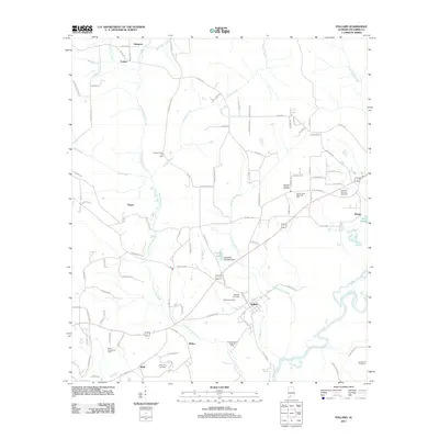
2011 Map of Pollard
USGS Topo · Published 2011About this map
Little Escambia Creek winds south through this corner of Alabama, connecting a series of small rural settlements including Pollard, Osaka, and Welka. The landscape is defined by its industrial and natural resources, featuring the Chavers Creek Oil Field and Fanny Church Oil Field. These energy sites are interspersed with family-named landmarks and infrastructure such as the Randolph Jernigan Dam on Jernigan Lake. To the southeast, the broad Conecuh River meanders across the territory, marking a significant hydrological feature of the region.
Find a feature on this map
96 named features on this map. Tap any name to fly to it.
Don’t see what you’re looking for? This feature index may not catch every label — zoom into the map to look around manually.
Map Details
Editions of this 2011 Pollard Map
This is the sole edition of this map. No revisions or reprints were ever made.
Other maps of this area

1941 · Century
USGS Topo · 1:62,500

1943 · Century
USGS Topo · 1:62,500

1943 · Jay
USGS Topo · 1:62,500

1953 · Andalusia
USGS Topo · 1:250,000

1957 · Andalusia
USGS Topo · 1:250,000

1957 · Pensacola
USGS Topo · 1:250,000

1959 · Pensacola
USGS Topo · 1:250,000

1959 · Brewton South
USGS Topo · 1:24,000

1960 · Pensacola
USGS Topo · 1:250,000

1960 · Brewton South
USGS Topo · 1:24,000