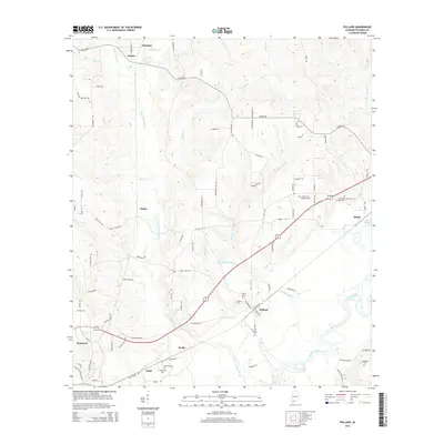
2014 Map of Pollard
USGS Topo · Published 2014About this map
Pollard and the surrounding Escambia County landscape are defined by the winding course of the Conecuh River and Little Escambia Cr. This 2014 survey documents the dense network of rural routes and family-named landmarks that characterize the region north of the Florida border. The topography is marked by several historical burial sites, including Hillcrest Cem and Pollard Cem near the town center, as well as Hollywood Cem further south in Wahl. The presence of Jernigan Lake and Lake Keego suggests a landscape shaped by both natural drainages and local land use. Smaller settlements like Osaka, Welka, and Foshee appear as nodes along the rail and road corridors, while the larger center of Flomaton anchors the southwestern portion of the map. This study provides a detailed view of the infrastructure and hydrological features that have supported these communities into the early 21st century.
Find a feature on this map
94 named features on this map. Tap any name to fly to it.
Don’t see what you’re looking for? This feature index may not catch every label — zoom into the map to look around manually.
Map Details
Editions of this 2014 Pollard Map
This is the sole edition of this map. No revisions or reprints were ever made.
Other maps of this area

1941 · Century
USGS Topo · 1:62,500

1943 · Century
USGS Topo · 1:62,500

1943 · Jay
USGS Topo · 1:62,500

1953 · Andalusia
USGS Topo · 1:250,000

1957 · Andalusia
USGS Topo · 1:250,000

1957 · Pensacola
USGS Topo · 1:250,000

1959 · Pensacola
USGS Topo · 1:250,000

1959 · Brewton South
USGS Topo · 1:24,000

1960 · Pensacola
USGS Topo · 1:250,000

1960 · Brewton South
USGS Topo · 1:24,000