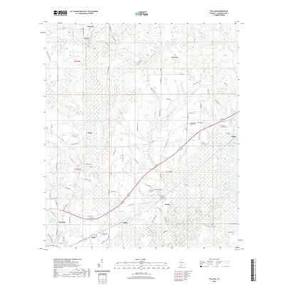
2020 Map of Pollard
USGS Topo · Published 2020About this map
Flomaton and Pollard anchor this portion of Escambia County, where the landscape is defined by the convergence of the Conecuh River and several major creek systems. The terrain is characterized by extensive wetlands and meandering waterways, including Little Escambia Cr and Chavers Creek, which wind through the township boundaries of t1n r8e and t2n r9e. Smaller settlements like Osaka, Welka, and Wahl are interspersed among the water-rich lowlands, showing a pattern of development closely tied to the available dry ground between the river's floodplains and the surrounding hills. Genealogists will find a significant concentration of burial sites, from larger plots like Green Acres Memorial Park to family and local landmarks such as Catawba Springs Cem, Henderson Cem, and Hollywood Cem. The presence of features like Jernigan Lake and Lake Keego further highlights the dominant role of hydrography in shaping the local geography.
Find a feature on this map
90 named features on this map. Tap any name to fly to it.
Don’t see what you’re looking for? This feature index may not catch every label — zoom into the map to look around manually.
Map Details
Editions of this 2020 Pollard Map
This is the sole edition of this map. No revisions or reprints were ever made.
Other maps of this area

1941 · Century
USGS Topo · 1:62,500

1943 · Century
USGS Topo · 1:62,500

1943 · Jay
USGS Topo · 1:62,500

1953 · Andalusia
USGS Topo · 1:250,000

1957 · Andalusia
USGS Topo · 1:250,000

1957 · Pensacola
USGS Topo · 1:250,000

1959 · Pensacola
USGS Topo · 1:250,000

1959 · Brewton South
USGS Topo · 1:24,000

1960 · Pensacola
USGS Topo · 1:250,000

1960 · Brewton South
USGS Topo · 1:24,000