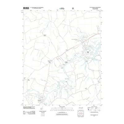
2011 Map of Pollocksville
USGS Topo · Published 2011About this map
Pollocksville sits at a critical bend of the Trent River, serving as a focal point for this Eastern North Carolina landscape. The map reveals a dense network of river-oriented landmarks, from historical crossings like Trent Bridge to numerous river access points such as Bells Landing and Taylor Landing. The terrain is defined by the winding river and its many tributaries, including Scott Creek, Beaver Branch, and the West Prong Raccoon Creek.
Find a feature on this map
90 named features on this map. Tap any name to fly to it.
Don’t see what you’re looking for? This feature index may not catch every label — zoom into the map to look around manually.
Map Details
Editions of this 2011 Pollocksville Map
This is the sole edition of this map. No revisions or reprints were ever made.
Other maps of this area

1901 · New Bern
USGS Topo · 1:62,500

1903 · New Bern
USGS Topo · 1:62,500

1903 · Trent River
USGS Topo · 1:62,500

1904 · Trent River
USGS Topo · 1:62,500

1942 · Maysville
USGS Topo · 1:62,500

1943 · Jacksonville
USGS Topo · 1:62,500

1948 · Maysville
USGS Topo · 1:62,500

1950 · Pollocksville
USGS Topo · 1:24,000

1950 · New Bern
USGS Topo · 1:24,000

1953 · Rocky Mount
USGS Topo · 1:250,000