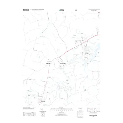
2013 Map of Pollocksville
USGS Topo · Published 2013About this map
Pollocksville sits at a historic crossing of the Trent River, where the landscape is defined by a dense network of coastal creeks and river landings. This 2013 survey documents the enduring importance of the river for both navigation and settlement, featuring numerous private and public access points like Debruhls Landing, Taylor Landing, and White Rock Landing. The map illustrates a transition from the structured residential development of River Bend in the northeast to the more dispersed rural communities of Rhems, Simmons Corner, and Tenmile Fork. Land management and infrastructure are evidenced by the Island Creek Fire Tower and the Canaan Air Base Airport, while local history is preserved in named crossings such as Trent Bridge and agricultural corridors like Hughes Farm Rd.
Find a feature on this map
89 named features on this map. Tap any name to fly to it.
Don’t see what you’re looking for? This feature index may not catch every label — zoom into the map to look around manually.
Map Details
Editions of this 2013 Pollocksville Map
This is the sole edition of this map. No revisions or reprints were ever made.
Other maps of this area

1901 · New Bern
USGS Topo · 1:62,500

1903 · New Bern
USGS Topo · 1:62,500

1903 · Trent River
USGS Topo · 1:62,500

1904 · Trent River
USGS Topo · 1:62,500

1942 · Maysville
USGS Topo · 1:62,500

1943 · Jacksonville
USGS Topo · 1:62,500

1948 · Maysville
USGS Topo · 1:62,500

1950 · Pollocksville
USGS Topo · 1:24,000

1950 · New Bern
USGS Topo · 1:24,000

1953 · Rocky Mount
USGS Topo · 1:250,000