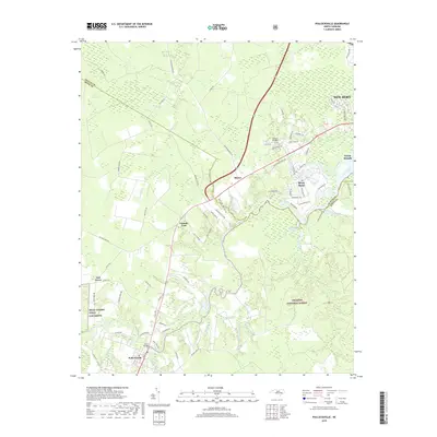
2019 Map of Pollocksville
USGS Topo · Published 2019About this map
Pollocksville and the surrounding coastal plains of Jones and Craven Counties are defined by the winding course of the Trent River. This landscape reflects a mix of suburban growth near New Bern, established rural settlements, and large protected areas. To the southeast, the Croatan National Forest occupies a significant portion of the terrain, characterized by numerous blackwater tributaries such as Skinner Br and Island Creek. Military activity is a prominent feature of the local geography, represented by MCAS Cherry Point Oak Grove and the Canaan Air Base. Smaller communities like Tenmile Fork, Rhems, and Oak Grove are linked by a network of rural roads that cross over wetlands including the Great Dover Swamp. Residential developments like River Bend and Trent Woods show the modern expansion along the river's edge, while older crossings are marked by Trent Bridge.
Find a feature on this map
83 named features on this map. Tap any name to fly to it.
Don’t see what you’re looking for? This feature index may not catch every label — zoom into the map to look around manually.
Map Details
Editions of this 2019 Pollocksville Map
This is the sole edition of this map. No revisions or reprints were ever made.
Other maps of this area

1901 · New Bern
USGS Topo · 1:62,500

1903 · New Bern
USGS Topo · 1:62,500

1903 · Trent River
USGS Topo · 1:62,500

1904 · Trent River
USGS Topo · 1:62,500

1942 · Maysville
USGS Topo · 1:62,500

1943 · Jacksonville
USGS Topo · 1:62,500

1948 · Maysville
USGS Topo · 1:62,500

1950 · Pollocksville
USGS Topo · 1:24,000

1950 · New Bern
USGS Topo · 1:24,000

1953 · Rocky Mount
USGS Topo · 1:250,000