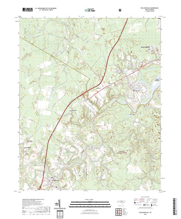
2022 Map of Pollocksville
USGS Topo · Published 2022About this map
The Trent River meanders across this landscape, serving as a defining geographical feature that separates the Croatan National Forest to the south from the developing residential areas and historic crossroads to the north. Settlement patterns here are clearly influenced by the river and its numerous tributaries, including Island Creek, Beaver Br, and Raccoon Cr. The town of Pollocksville sits near the river's edge, anchored by the Pollocksville Cem and local road networks like Co RD 1331.
Find a feature on this map
83 named features on this map. Tap any name to fly to it.
Don’t see what you’re looking for? This feature index may not catch every label — zoom into the map to look around manually.
Map Details
Editions of this 2022 Pollocksville Map
This is the sole edition of this map. No revisions or reprints were ever made.
Other maps of this area

1901 · New Bern
USGS Topo · 1:62,500

1903 · New Bern
USGS Topo · 1:62,500

1903 · Trent River
USGS Topo · 1:62,500

1904 · Trent River
USGS Topo · 1:62,500

1942 · Maysville
USGS Topo · 1:62,500

1943 · Jacksonville
USGS Topo · 1:62,500

1948 · Maysville
USGS Topo · 1:62,500

1950 · Pollocksville
USGS Topo · 1:24,000

1950 · New Bern
USGS Topo · 1:24,000

1953 · Rocky Mount
USGS Topo · 1:250,000