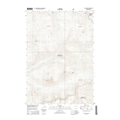
2015 Map of Pollux Peak
USGS Topo · Published 2015About this map
Yellowstone National Park and the Shoshone National Forest converge in this high-altitude wilderness within the Absaroka Range. The landscape is dominated by significant summits including the twin-like Pollux Peak and Castor Peak, along with Grant Peak and Saddle Mtn. These peaks form the drainage basin for the Lamar River and its tributary, the Little Lamar River, which cut through the steep topography.
Find a feature on this map
20 named features on this map. Tap any name to fly to it.
Don’t see what you’re looking for? This feature index may not catch every label — zoom into the map to look around manually.
Map Details
Editions of this 2015 Pollux Peak Map
This is the sole edition of this map. No revisions or reprints were ever made.
Other maps of this area

1886 · Canyon
USGS Topo · 1:125,000

1895 · Canyon
USGS Topo · 1:125,000

1896 · Canyon
USGS Topo · 1:125,000

1896 · Crandall Creek
USGS Topo · 1:125,000

1899 · Crandall
USGS Topo · 1:125,000

1901 · Canyon
USGS Topo · 1:125,000

1907 · Canyon
USGS Topo · 1:125,000

1911 · Canyon
USGS Topo · 1:125,000

1955 · Ashton
USGS Topo · 1:250,000

1955 · Cody
USGS Topo · 1:250,000