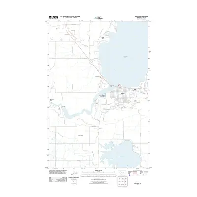
2011 Map of Polson
USGS Topo · Published 2011About this map
The south shore of Flathead Lake serves as the focal point for this study of the Polson area, where the Flathead River begins its westward journey. The landscape is defined by the complex water management system of the Mission Valley, featuring the Polson B Canal, Polson C Canal, and the Pablo 31 A 07 Canal feeding into the Pablo Reservoir. Civil engineering marks the terrain at Kerr Dam and the Polson Sewage Lagoon Dam, while the town itself shows a developed grid with community landmarks such as Belle-Vue Court and Lakeview Cemetery. To the north, the residential expansion onto Rocky Point contrasts with the higher elevations of Rocky Butte to the south. Local transit and services are anchored by the Polson Airport, Polson Bridge, and the Polson Post Office, reflecting the town's role as a regional hub for commerce and recreation.
Find a feature on this map
71 named features on this map. Tap any name to fly to it.
Don’t see what you’re looking for? This feature index may not catch every label — zoom into the map to look around manually.
Map Details
Editions of this 2011 Polson Map
This is the sole edition of this map. No revisions or reprints were ever made.
Other maps of this area

1920 · Flathead Lake
USGS Topo · 1:125,000

1956 · Wallace
USGS Topo · 1:250,000

1960 · Wallace
USGS Topo · 1:250,000

1964 · Bull Island
USGS Topo · 1:24,000

1964 · Buffalo Bridge
USGS Topo · 1:24,000

1964 · Wild Horse Island
USGS Topo · 1:24,000

1964 · East Bay
USGS Topo · 1:24,000

1964 · Elmo
USGS Topo · 1:24,000

1964 · Polson
USGS Topo · 1:24,000

1964 · Ronan
USGS Topo · 1:24,000