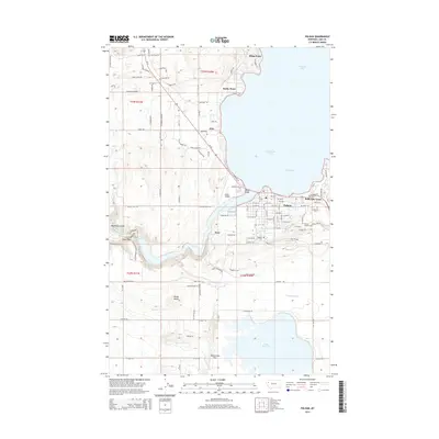
2014 Map of Polson
USGS Topo · Published 2014About this map
Polson sits prominently at the southern end of Flathead Lake on this 2014 survey, where the Flathead River begins its westward journey. The landscape is defined by the managed flow of water, evidenced by the extensive canal system including the Polson-B-Canal and Polson-C-Canal, which support the region's agricultural infrastructure alongside the Pablo 31 A 07 Canal feeding into Pablo Reservoir. This era of mapping reveals a mix of residential expansion in areas like Belle-Vue Court and the small settlement of Jette to the north, contrasted with the natural elevations of Kings Point and Rocky Point. Genealogists will find several burial sites noted, including the Polson Catholic Cem, Lakeview Cem, and Hospital Cem. Landmarks like the Polson Airport and the Kerr area near the river's bend highlight the intersection of transportation and industrial utility in Lake County.
Find a feature on this map
84 named features on this map. Tap any name to fly to it.
Don’t see what you’re looking for? This feature index may not catch every label — zoom into the map to look around manually.
Map Details
Editions of this 2014 Polson Map
This is the sole edition of this map. No revisions or reprints were ever made.
Other maps of this area

1920 · Flathead Lake
USGS Topo · 1:125,000

1956 · Wallace
USGS Topo · 1:250,000

1960 · Wallace
USGS Topo · 1:250,000

1964 · Bull Island
USGS Topo · 1:24,000

1964 · Buffalo Bridge
USGS Topo · 1:24,000

1964 · Wild Horse Island
USGS Topo · 1:24,000

1964 · East Bay
USGS Topo · 1:24,000

1964 · Elmo
USGS Topo · 1:24,000

1964 · Polson
USGS Topo · 1:24,000

1964 · Ronan
USGS Topo · 1:24,000