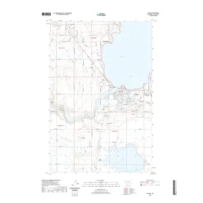
2020 Map of Polson
USGS Topo · Published 2020About this map
Polson and the southern shores of Flathead Lake anchor this topographic landscape, where the town’s development is defined by its proximity to Polson Bay and the winding Flathead River. The infrastructure for regional water management is prominent, featuring the Polson B Canal, Polson C Canal, and Pablo 31 A 07 Canal, which move water toward the expansive Pablo Reservoir in the south. These irrigation systems reflect the area's agricultural foundations, while landmarks like the Lake County Courthouse and Polson Airport mark its role as a civic and transportation hub.
Find a feature on this map
92 named features on this map. Tap any name to fly to it.
Don’t see what you’re looking for? This feature index may not catch every label — zoom into the map to look around manually.
Map Details
Editions of this 2020 Polson Map
This is the sole edition of this map. No revisions or reprints were ever made.
Other maps of this area

1920 · Flathead Lake
USGS Topo · 1:125,000

1956 · Wallace
USGS Topo · 1:250,000

1960 · Wallace
USGS Topo · 1:250,000

1964 · Bull Island
USGS Topo · 1:24,000

1964 · Buffalo Bridge
USGS Topo · 1:24,000

1964 · Wild Horse Island
USGS Topo · 1:24,000

1964 · East Bay
USGS Topo · 1:24,000

1964 · Elmo
USGS Topo · 1:24,000

1964 · Polson
USGS Topo · 1:24,000

1964 · Ronan
USGS Topo · 1:24,000