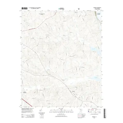
2014 Map of Pomaria
USGS Topo · Published 2014About this map
The Sumter National Forest defines the northwestern reaches of this Newberry County landscape, where the terrain slopes toward the Broad River and the expansive Parr Shoals Reservoir. The settlement of Pomaria serves as a central hub for the surrounding rural area, characterized by a network of family-named roads and numerous small burial grounds. Local history and genealogy researchers will find several well-preserved locations such as Pomaria Cem, Bethlehem Cem, and Saint Matthews Cem. The hydrology is particularly intricate here, with Cannons Cr, Mud Cr, and Hellers Cr carving paths through the woodlands toward the river basin. Smaller junctions like Taylors Crossroads illustrate the traditional crossroads settlement pattern that persists in this part of South Carolina, while the presence of landmarks like Wicker Cem and Stone Cem offer specific points of interest for those tracing local family roots.
Find a feature on this map
69 named features on this map. Tap any name to fly to it.
Don’t see what you’re looking for? This feature index may not catch every label — zoom into the map to look around manually.
Map Details
Editions of this 2014 Pomaria Map
This is the sole edition of this map. No revisions or reprints were ever made.
Other maps of this area

1904 · Columbia
USGS Topo · 1:125,000

1941 · Spartanburg
USGS Topo · 1:250,000

1953 · Spartanburg
USGS Topo · 1:250,000

1960 · Spartanburg
USGS Topo · 1:250,000

1963 · Spartanburg
USGS Topo · 1:250,000

1964 · Spartanburg
USGS Topo · 1:250,000

1968 · Newberry East
USGS Topo · 1:24,000

1969 · Whitmire South
USGS Topo · 1:24,000

1969 · Pomaria
USGS Topo · 1:24,000

1969 · Blair
USGS Topo · 1:24,000