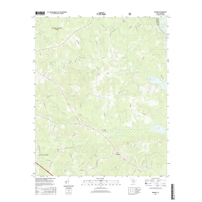
2017 Map of Pomaria
USGS Topo · Published 2017About this map
Pomaria serves as the focal point of this modern topographic record, where the local road network and residential footprints meet the eastern edge of the Sumter National Forest. The landscape is defined by the drainage systems of Hellers Creek, Crims Creek, and Cannons Creek, which flow toward the Parr Shoals Reservoir on the eastern boundary. For those tracing local families, the map includes several small burial sites, including Stone Cemetery near Taylors Crossroads and Bethlehem Cemetery further north. Historical transportation patterns remain visible through named thoroughfares such as Hughey Ferry Road, which once led toward the river crossings on the Broad River. The survey illustrates a rural South Carolina community where large tracts of forest land and water management infrastructure coexist with century-old settlements.
Find a feature on this map
66 named features on this map. Tap any name to fly to it.
Don’t see what you’re looking for? This feature index may not catch every label — zoom into the map to look around manually.
Map Details
Editions of this 2017 Pomaria Map
This is the sole edition of this map. No revisions or reprints were ever made.
Other maps of this area

1904 · Columbia
USGS Topo · 1:125,000

1941 · Spartanburg
USGS Topo · 1:250,000

1953 · Spartanburg
USGS Topo · 1:250,000

1960 · Spartanburg
USGS Topo · 1:250,000

1963 · Spartanburg
USGS Topo · 1:250,000

1964 · Spartanburg
USGS Topo · 1:250,000

1968 · Newberry East
USGS Topo · 1:24,000

1969 · Whitmire South
USGS Topo · 1:24,000

1969 · Pomaria
USGS Topo · 1:24,000

1969 · Blair
USGS Topo · 1:24,000