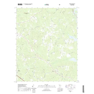
2020 Map of Pomaria
USGS Topo · Published 2020About this map
Pomaria serves as the central hub of this Newberry County landscape, where rural road networks converge near the banks of Crims Cr. The area is defined by its deep genealogical roots, evidenced by numerous family and community burial grounds such as Wicker Cem, Stone Cem, and Saint Matthews Cem. To the north and west, the protected lands of the Sumter National Forest preserve the timbered drainage basins of Hellers Cr and Buck Br. The eastern edge of the quadrangle is marked by the sprawling waters of the Parr Shoals Reservoir at the Broad River, a critical hydrological feature for the region. Significant local travel routes like Hughey Ferry Rd and Jollystreet Rd connect isolated crossroads such as Taylors Crossroads to the larger agricultural and forest economy of central South Carolina.
Find a feature on this map
67 named features on this map. Tap any name to fly to it.
Don’t see what you’re looking for? This feature index may not catch every label — zoom into the map to look around manually.
Map Details
Editions of this 2020 Pomaria Map
This is the sole edition of this map. No revisions or reprints were ever made.
Other maps of this area

1904 · Columbia
USGS Topo · 1:125,000

1941 · Spartanburg
USGS Topo · 1:250,000

1953 · Spartanburg
USGS Topo · 1:250,000

1960 · Spartanburg
USGS Topo · 1:250,000

1963 · Spartanburg
USGS Topo · 1:250,000

1964 · Spartanburg
USGS Topo · 1:250,000

1968 · Newberry East
USGS Topo · 1:24,000

1969 · Whitmire South
USGS Topo · 1:24,000

1969 · Pomaria
USGS Topo · 1:24,000

1969 · Blair
USGS Topo · 1:24,000