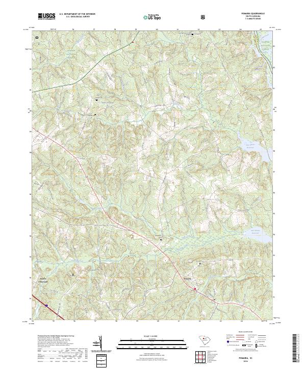
2024 Map of Pomaria
USGS Topo · Published 2024About this map
Pomaria serves as the focal point of this rural Newberry County landscape, where the intersection of traditional church sites and family burial grounds reveals a deep-seated community structure. The settlement patterns are anchored by several historic cemeteries, including Graham Cem, Wicker Cem, and Bethlehem Cem, which reflect the genealogy of the area's early residents. To the northeast, the Broad River and Parr Shoals Reservoir define the topography, with Griffins Shoal marking the river's natural character within the Sumter National Forest.
Find a feature on this map
69 named features on this map. Tap any name to fly to it.
Don’t see what you’re looking for? This feature index may not catch every label — zoom into the map to look around manually.
Map Details
Editions of this 2024 Pomaria Map
This is the sole edition of this map. No revisions or reprints were ever made.
Other maps of this area

1904 · Columbia
USGS Topo · 1:125,000

1941 · Spartanburg
USGS Topo · 1:250,000

1953 · Spartanburg
USGS Topo · 1:250,000

1960 · Spartanburg
USGS Topo · 1:250,000

1963 · Spartanburg
USGS Topo · 1:250,000

1964 · Spartanburg
USGS Topo · 1:250,000

1968 · Newberry East
USGS Topo · 1:24,000

1969 · Whitmire South
USGS Topo · 1:24,000

1969 · Pomaria
USGS Topo · 1:24,000

1969 · Blair
USGS Topo · 1:24,000