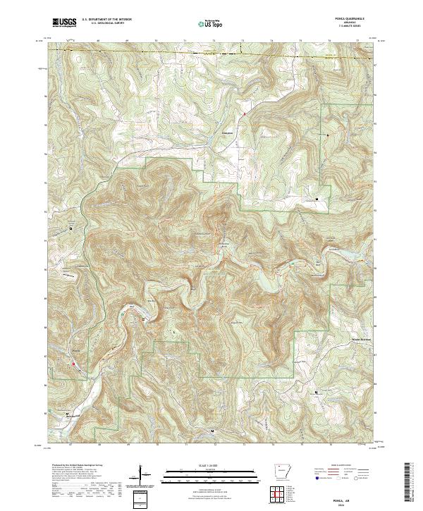
2024 Map of Ponca
USGS Topo · Published 2024About this map
Buffalo River carving through the heart of the Ozarks defines the character of this modern topographical survey. The map records the intricate network of vertical relief and riparian landscape protected within the Buffalo National River and the adjacent Buffalo National River Wilderness. Settlement patterns are concentrated around the communities of Ponca, Compton, and Beechwood, while the higher elevations are marked by distinctive landmarks such as Roark Bluff, Big Bluff, and Bee Bluff. Genealogists will find several small family and community burial grounds, including Mountain Springs Cem and Mount Sherman Cem. The terrain is characterized by numerous hollows and prongs, such as Sneeds Creek and Cecil Hollow, which feed into the main river system. This contemporary data provides a clear view of the existing road network, from established routes like Co RD 19 to specialized paths like the Old River Trl.
Find a feature on this map
103 named features on this map. Tap any name to fly to it.
Don’t see what you’re looking for? This feature index may not catch every label — zoom into the map to look around manually.
Map Details
Editions of this 2024 Ponca Map
This is the sole edition of this map. No revisions or reprints were ever made.
Other maps of this area

1904 · Harrison
USGS Topo · 1:125,000

1905 · Harrison
USGS Topo · 1:125,000

1933 · Mt Judea
USGS Topo · 1:62,500

1940 · Mt Judea
USGS Topo · 1:62,500

1945 · Harrison
USGS Topo · 1:250,000

1949 · Harrison
USGS Topo · 1:250,000

1954 · Harrison
USGS Topo · 1:250,000

1956 · Russellville
USGS Topo · 1:250,000

1958 · Harrison
USGS Topo · 1:250,000

1964 · Russellville
USGS Topo · 1:250,000