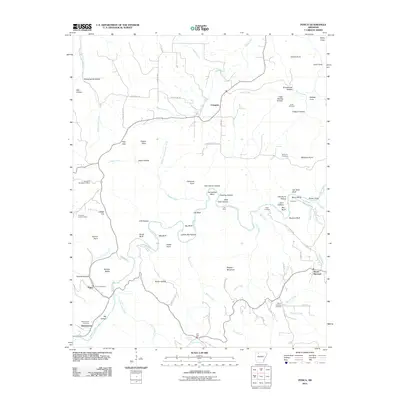
2011 Map of Ponca
USGS Topo · Published 2011About this map
The Buffalo River snakes through this corner of the Ozarks, carving a deep corridor defined by massive geological features like Big Bluff, Jim Bluff, and the towering Roark Bluff. This landscape is marked by a high concentration of hollows and coves, such as Hemmed-In Hollow and Dewey Cove, which historically dictated the movement of residents between the high points and the river bottom. The settlement at Ponca serves as a focal point, anchored by the Ponca Post Office and nearby Beechwood Cemetery. Further north, Compton overlooks the terrain near the Compton Lookout Tower. The map documents a network of primitive crossings and access points like Lick Ford and Kyles Landing, illustrating how remote communities in Newton County maintained connectivity through the river valley at the start of the 21st century.
Find a feature on this map
91 named features on this map. Tap any name to fly to it.
Don’t see what you’re looking for? This feature index may not catch every label — zoom into the map to look around manually.
Map Details
Editions of this 2011 Ponca Map
This is the sole edition of this map. No revisions or reprints were ever made.
Other maps of this area

1904 · Harrison
USGS Topo · 1:125,000

1905 · Harrison
USGS Topo · 1:125,000

1933 · Mt Judea
USGS Topo · 1:62,500

1940 · Mt Judea
USGS Topo · 1:62,500

1945 · Harrison
USGS Topo · 1:250,000

1949 · Harrison
USGS Topo · 1:250,000

1954 · Harrison
USGS Topo · 1:250,000

1956 · Russellville
USGS Topo · 1:250,000

1958 · Harrison
USGS Topo · 1:250,000

1964 · Russellville
USGS Topo · 1:250,000