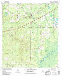
1994 Map of Ponce De Leon
USGS Topo · Published 1998About this map
Ponce de Leon serves as the focal point of this Panhandle landscape, where the waters of Jackson Spring feed into the notable Ponce de Leon Springs State Recreation Area. The surrounding area in Walton and Holmes counties is defined by a dense network of water bodies and rural landmarks, from the cypress-laden basins of Jenkins Bay and Wolf Bay to the numerous family and community churches that dot the countryside, including Knox Hill Ch and Andrew Chapel Ch.
Find a feature on this map
65 named features on this map. Tap any name to fly to it.
Don’t see what you’re looking for? This feature index may not catch every label — zoom into the map to look around manually.
Map Details
Editions of this 1994 Ponce De Leon Map
This is the sole edition of this map. No revisions or reprints were ever made.
Other maps of this area

1935 · De Funiak Springs
USGS Topo · 1:48,000

1938 · De Funiak Springs
USGS Topo · 1:62,500

1948 · Ponce De Leon
USGS Topo · 1:24,000

1949 · Glendale
USGS Topo · 1:62,500

1949 · Millers Ferry
USGS Topo · 1:24,000

1949 · Redbay
USGS Topo · 1:24,000

1949 · Hinsons Cross Roads
USGS Topo · 1:24,000

1949 · Caryville
USGS Topo · 1:24,000

1950 · Prosperity
USGS Topo · 1:24,000

1950 · Millers Ferry
USGS Topo · 1:24,000