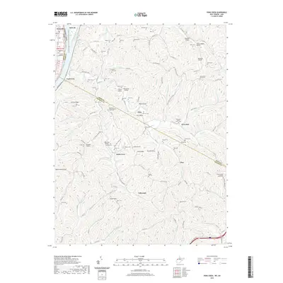
2019 Map of Pond Creek
USGS Topo · Published 2019About this map
Belleville and the surrounding river bottomlands of Wood Co and Jackson Co characterize this West Virginia landscape along the Ohio River. The terrain is defined by a dense network of runs and creeks, including Pond Creek and Jerrys Run, which carve through ridges such as Milhoan Ridge and Shaffer Ridge. Genealogical interest is particularly high here, with dozens of family-named burial grounds like the Isabelle Flinn Cem and Shafer Cem scattered across the hollows. Small communities and historical gathering points such as Flinn, Topins Grove, and Willowdale anchor the rural road network. The map captures the prominence of high points like Buzzard Roost Knob and Shafer Knob, which overlook a landscape dotted with country churches, including the Mount Zion United Methodist Church Cem and Pond Creek Baptist Church Cem. Across the river, Reedsville and Long Bottom show the Ohio side of this interconnected valley corridor.
Find a feature on this map
156 named features on this map. Tap any name to fly to it.
Don’t see what you’re looking for? This feature index may not catch every label — zoom into the map to look around manually.
Map Details
Editions of this 2019 Pond Creek Map
This is the sole edition of this map. No revisions or reprints were ever made.
Other maps of this area

1906 · Belleville
USGS Topo · 1:62,500

1907 · Keno
USGS Topo · 1:62,500

1907 · Ripley
USGS Topo · 1:62,500

1908 · Ravenswood
USGS Topo · 1:62,500

1924 · Belleville
USGS Topo · 1:62,500

1926 · Ravenswood
USGS Topo · 1:62,500

1926 · Belleville
USGS Topo · 1:62,500

1926 · Ripley
USGS Topo · 1:62,500

1928 · Ravenswood
USGS Topo · 1:62,500

1928 · Ripley
USGS Topo · 1:62,500