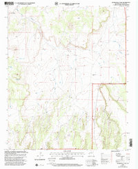
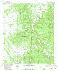
1999 Map of Ponderosa Tank
USGS Topo · Published 2002About this map
Apache National Forest dominates this landscape in Catron County, New Mexico, where the terrain is marked by a network of water management features essential for ranching and forest operations. Ranching infrastructure is prominent, including several Corral sites and water sources such as the North Windmill, South Well, and Water Tanks. The drainage of Agua Fria Creek moves through the northern sections, while family-named landmarks like Sanchez provide evidence of local land use. This 1999 revision by the USDA Forest Service updates topographical data originally compiled in 1969, reflecting the persistent reliance on scattered water points like Antelope Tank, Year Long Tank, and the namesake Ponderosa Tank in an arid, high-elevation environment where 4WD tracks serve as the primary conduits through the forest boundary.
Find a feature on this map
15 named features on this map. Tap any name to fly to it.
Don’t see what you’re looking for? This feature index may not catch every label — zoom into the map to look around manually.
Map Details
Editions of this 1999 Ponderosa Tank Map
This is the sole edition of this map. No revisions or reprints were ever made.
Other maps of this area

1954 · Saint Johns
USGS Topo · 1:250,000

1955 · Red Hill
USGS Topo · 1:24,000

1957 · Saint Johns
USGS Topo · 1:250,000

1958 · Saint Johns
USGS Topo · 1:250,000

1962 · Saint Johns
USGS Topo · 1:250,000
1972 · Red Hill
USGS Topo · 1:24,000

1972 · Blaines Lake
USGS Topo · 1:24,000
1972 · Armstrong Canyon
USGS Topo · 1:24,000
1981 · Ponderosa Tank
USGS Topo · 1:24,000
1981 · Largo Mesa
USGS Topo · 1:24,000