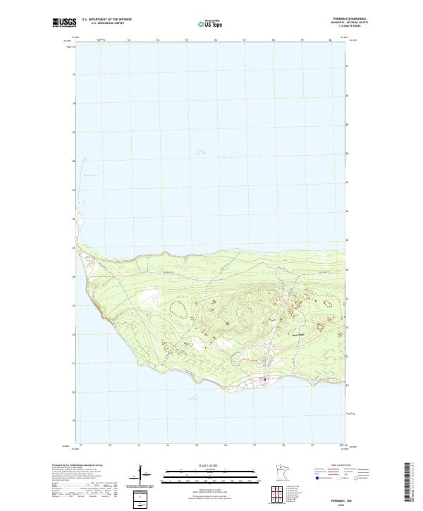
2022 Map of Ponemah
USGS Topo · Published 2022About this map
Upper Red Lake and Lower Red Lake dominate this northern Minnesota landscape, joined by the distinctive passage known as The Narrows. The settlement of Ponemah is situated on the peninsula between these two massive water bodies, serving as a focal point for the local road network. The geography here is defined by its lacustrine orientation, where the land narrows significantly to separate the two basins. Navigation and transit across this land bridge are facilitated by a series of reservation routes, including Resvn Hwy 18 and Resvn Hwy 49, which provide access to the interior wetlands and shoreline points. Local landmarks like Ptown 2nd Loop and Camp Rd illustrate the modern community layout within the Red Lake Reservation during the early twenty-first century.
Find a feature on this map
19 named features on this map. Tap any name to fly to it.
Don’t see what you’re looking for? This feature index may not catch every label — zoom into the map to look around manually.
Map Details
Editions of this 2022 Ponemah Map
This is the sole edition of this map. No revisions or reprints were ever made.
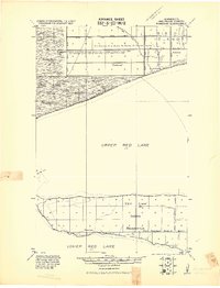
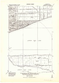
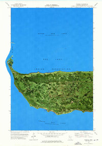
Historical Maps of Ponemah Through Time
4 maps found