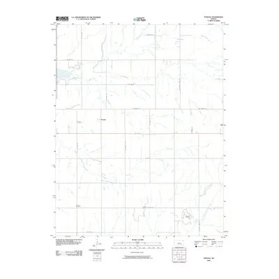
2009 Map of Pontiac
USGS Topo · Published 2009About this map
Pontiac serves as the central settlement in this portion of Butler County, surrounded by a landscape defined by an extensive network of prairie waterways. The drainage pattern is led by the North Branch Little Walnut River in the southeast and complemented by Bird Creek, Bemis Creek, and Shady Creek. This survey captures the rural infrastructure of the early 21st century, where section-line roads like NE Satchell Creek Rd and SE Munson Hill Rd carve a strict grid across the undulating terrain.
Find a feature on this map
27 named features on this map. Tap any name to fly to it.
Don’t see what you’re looking for? This feature index may not catch every label — zoom into the map to look around manually.
Map Details
Editions of this 2009 Pontiac Map
This is the sole edition of this map. No revisions or reprints were ever made.
Other maps of this area

1888 · Eldorado
USGS Topo · 1:125,000

1955 · Wichita
USGS Topo · 1:250,000

1958 · Wichita
USGS Topo · 1:250,000

1961 · Pontiac
USGS Topo · 1:24,000

1961 · De Graff
USGS Topo · 1:24,000

1961 · Rosalia NE
USGS Topo · 1:24,000

1961 · El Dorado
USGS Topo · 1:24,000

1961 · Rosalia
USGS Topo · 1:24,000
1961 · Rosalia NW
USGS Topo · 1:24,000

1963 · Leon
USGS Topo · 1:24,000