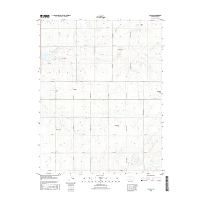
2015 Map of Pontiac
USGS Topo · Published 2015About this map
Pontiac and Rosalia serve as the primary hubs for this rural Butler County landscape, where the prairie is dissected by a dense network of seasonal and perennial waterways. The northwestern corner is defined by the reach of El Dorado Lake, which receives inflow from Bemis Cr. Further south and east, the drainage patterns shift toward the N Br Little Walnut River and its various tributaries, including Bird Cr and De Haas Cr.
Find a feature on this map
38 named features on this map. Tap any name to fly to it.
Don’t see what you’re looking for? This feature index may not catch every label — zoom into the map to look around manually.
Map Details
Editions of this 2015 Pontiac Map
This is the sole edition of this map. No revisions or reprints were ever made.
Other maps of this area

1888 · Eldorado
USGS Topo · 1:125,000

1955 · Wichita
USGS Topo · 1:250,000

1958 · Wichita
USGS Topo · 1:250,000

1961 · Pontiac
USGS Topo · 1:24,000

1961 · De Graff
USGS Topo · 1:24,000

1961 · Rosalia NE
USGS Topo · 1:24,000

1961 · El Dorado
USGS Topo · 1:24,000

1961 · Rosalia
USGS Topo · 1:24,000
1961 · Rosalia NW
USGS Topo · 1:24,000

1963 · Leon
USGS Topo · 1:24,000