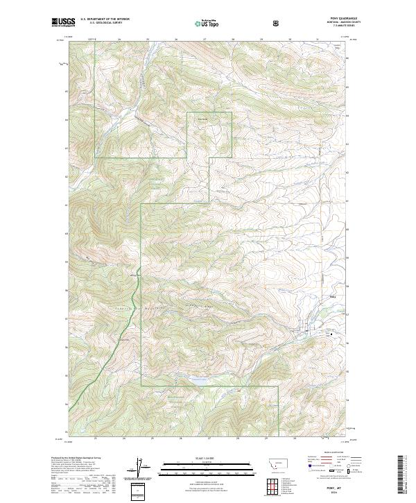
2024 Map of Pony
USGS Topo · Published 2024About this map
Pony lies at the eastern edge of the Tobacco Root Mountains, serving as a gateway to the high-elevation terrain and alpine water sources of southwest Montana. The landscape is defined by its dramatic elevation changes, rising from the Summit Valley and Hog Hollow Creek toward prominent peaks and ridges like Strawberry Ridge and Queens Hill. This modern survey illustrates the complex boundary between the Deerlodge National Forest and the Beaverhead National Forest, which meet along the high country of Windy Pass. Local water management is evident in the path of the Church Ditch, which draws from the South Boulder River. For genealogists, the Pony Cem remains a central landmark for the community, while the network of forest roads like Pony Creek Rd and N Willow Creek Rd provide access to remote areas including Cataract Lake.
Find a feature on this map
44 named features on this map. Tap any name to fly to it.
Don’t see what you’re looking for? This feature index may not catch every label — zoom into the map to look around manually.
Map Details
Editions of this 2024 Pony Map
This is the sole edition of this map. No revisions or reprints were ever made.
Other maps of this area

1888 · Three Forks
USGS Topo · 1:250,000

1893 · Dillon
USGS Topo · 1:250,000

1894 · Three Forks
USGS Topo · 1:250,000

1895 · Three Forks
USGS Topo · 1:250,000

1947 · Bozeman
USGS Topo · 1:250,000

1948 · Bozeman
USGS Topo · 1:250,000

1950 · Jefferson Island
USGS Topo · 1:62,500

1950 · Harrison
USGS Topo · 1:62,500

1955 · Bozeman
USGS Topo · 1:250,000

1955 · Dillon
USGS Topo · 1:250,000